- Connectivity Business HOME
- service·
solution -
event·
Seminar
-
Case studies, columns,
Blog
- Inquiry
product
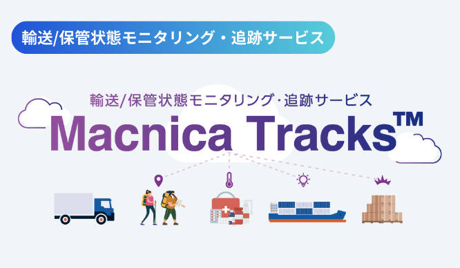
- Transportation/storage status monitoring and tracking service - Macnica Tracks® -
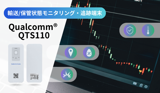
- Transportation/storage status monitoring and tracking terminal - Qualcomm® QTS110 -
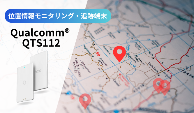
- Location monitoring and tracking device - Qualcomm® QTS112 -
- [FAQ] Transportation/storage condition monitoring and tracking service - Macnica Tracks® -
- List of documents
What can you do with Macnica Tracks™'s "Shipping Information" feature?
Introduction
In this article,Macnica Tracks™We will introduce how to use "Shipping Information", one of the functions.
"Delivery Information" is a function that allows you to manage the condition of the transported goods (temperature, humidity, air pressure, opening, impact, etc.) on a delivery unit basis by setting the departure point/date and time, intermediate points, and arrival point/date and time on each device, linking it to location information and time.
At any given point in time, you can check "where the luggage is" and "when it will arrive at its destination."
By sharing the dashboard with warehouses and shippers, you can keep track of the situation without having to communicate with them.
In addition, the Macnica Tracks™ monitoring terminal (QTS110 / 112) has a built-in global eSIM, so you can find out your route after arriving overseas without having to pay any additional fees or change your plan.
This "shipping information" function allows you to manage information obtained both domestically and internationally,
This is a feature we especially recommend for those shipping overseas where there is a high risk of theft or loss.
Now, let's introduce the functions and benefits of "Shipping Information" using an actual example of shipping from within Japan to Las Vegas via Los Angeles, USA.
Functions and benefits of "Shipping Information"
Device information during delivery
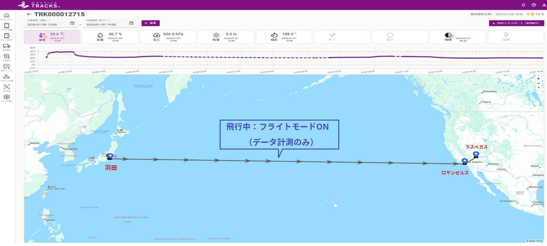
Figure 1. Device information (with additional notes)
This delivery will depart Japan at approximately 8pm on January 6th, arrive in Los Angeles at approximately 11am on January 7th, and then continue on to Las Vegas.
Since radio waves cannot be emitted during flight, flight mode is turned on and data measurement continues.
During this time, the measurement frequency will be extended to [transmission interval setting x 4] to reduce battery consumption, and the accumulated data will be sent to the cloud after landing.
What is Flight Mode?
This function determines when an aircraft is taking off or landing based on information from the acceleration sensor and tilt sensor, and automatically switches data transmission on and off.
If portable electronic devices such as data loggers for quality control purposes are used during the flight, they must be listed on the Electronic Device Approval List prepared by each airline.
In principle, communications must be turned off between takeoff and landing.
Only devices with a specific communication signal power strength and flight mode can be checked in without being turned off beforehand.
Therefore, when using a monitoring device for air transport, it is important that the device is capable of supporting flight mode, like this device.
Macnica Tracks™ QTS110 has been approved by major domestic and international airlines. Please contact us for more information.
Shipping function page
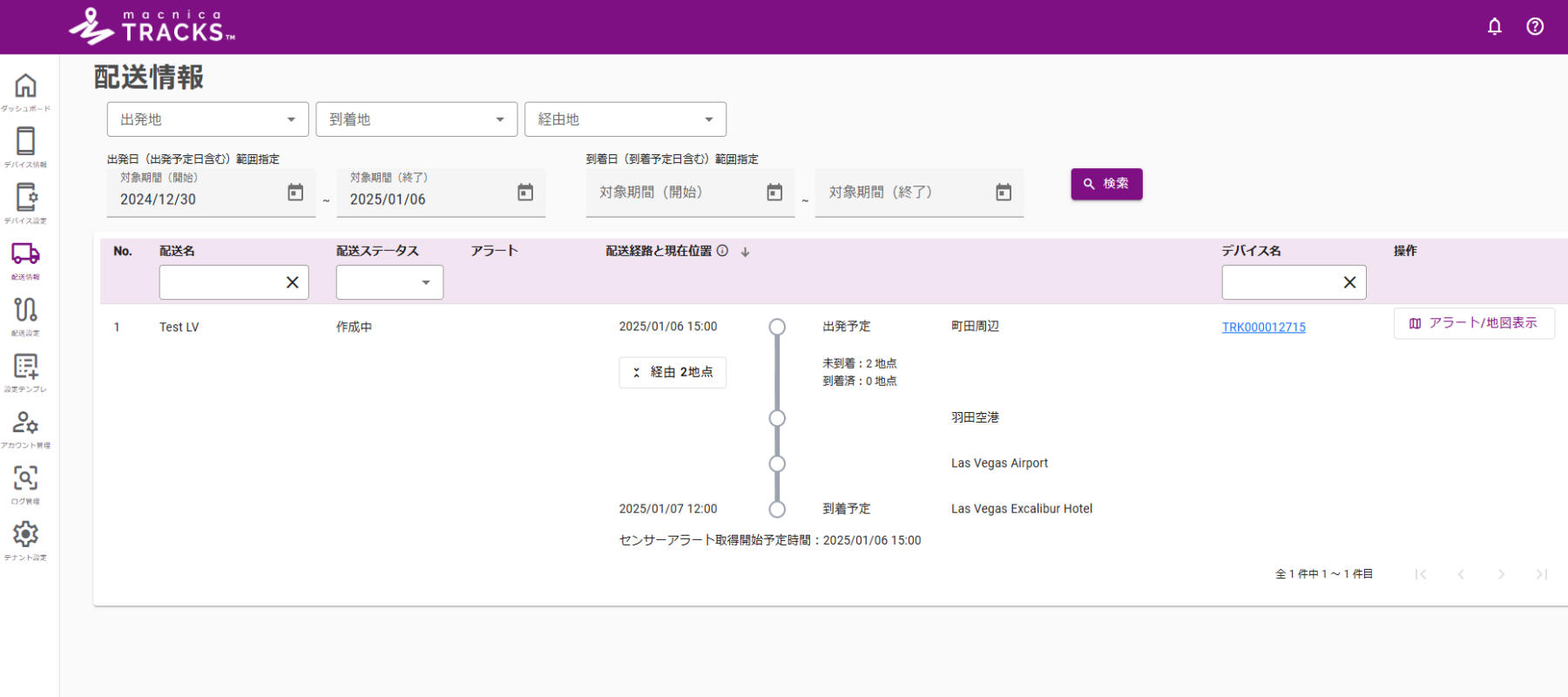
Figure 2. Pre-departure delivery function page
When you register a new delivery, the route will be displayed like this.
Location information can be registered in the delivery settings, and the geofence range can be freely set within a radius of 1m to 100km.
Once delivery begins, the information obtained by the device will be used to reflect the route shown above.
Delivery status updates (prepared to depart, arrived at transit point, completed, suspended, etc.) and delivery errors (delivery preparation incomplete, arrival delay, etc.)
You can be notified by email, so there's no need to constantly monitor the dashboard.
Additionally, during a delivery, an estimated arrival time button will appear below the Alerts / Map View button to calculate the time of arrival at your destination.
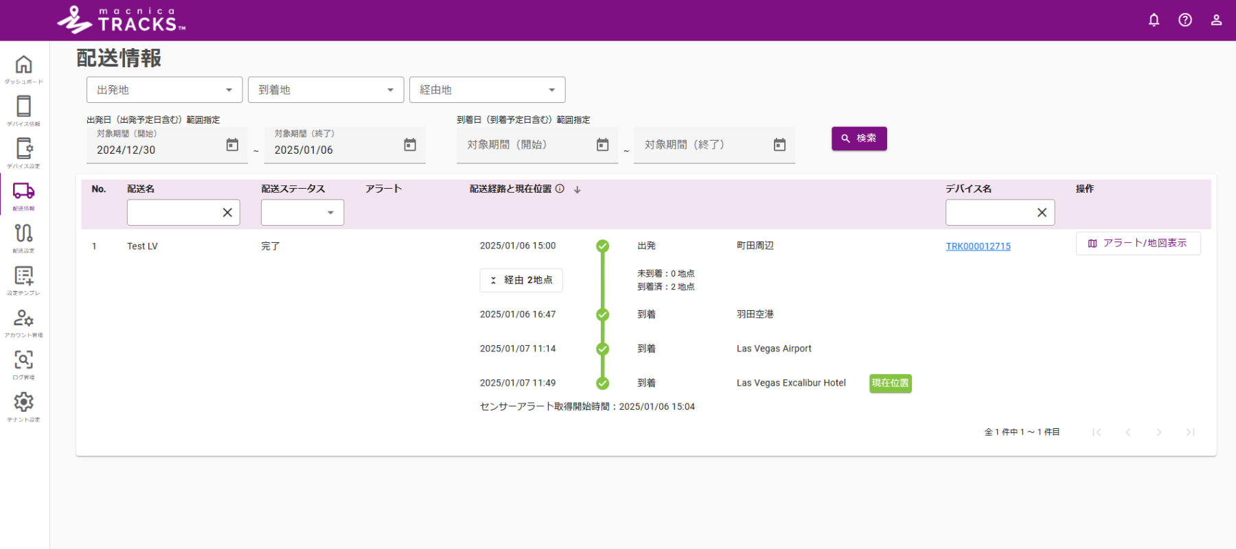
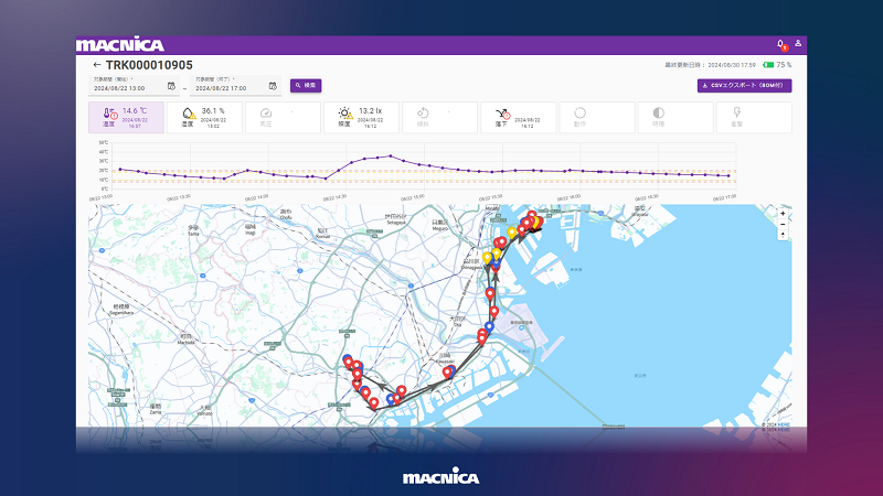
Figure 3. Completed shipping function page
Once delivery is complete, the display will look like this, allowing you to see all delivery information at a glance.
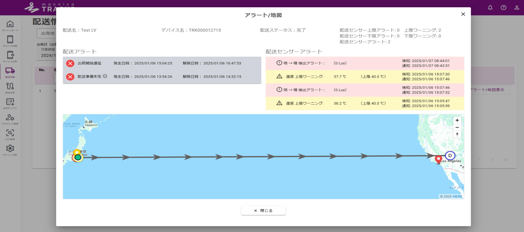
Figure 4. Alerts/Map
When you open the Alerts / Map view, you can see only the alerts.
If damage to a package is discovered after it arrives, management is easy as you can view only the alert information for that delivery.
What is the geofencing feature?
This function uses location information to virtually surround a specific area and executes specific actions when you enter or exit that area.
By utilizing the geofencing function, it is possible to predict events and times related to delivery routes, reducing unnecessary business communications and waiting times.
customer's voice
Use the "Delivery Information" feature for more efficient management
Here we will introduce some testimonials from customers who have actually used the product.
The benefits were particularly apparent among those who wanted to improve delivery quality through logistics digital transformation and those who wanted to increase work efficiency and reduce the burden on the field.
- You can change the delivery name, making it easy to manage each delivery destination.
・ The good points and areas for improvement of the delivery route became clear
・We were able to identify the cause of quality issues that had not been resolved
Reduced the burden of creating reports for customers
・ It can also be used to test the delivery environment, creating an environment that can maintain higher quality.
・Because advance notice is given when a shipment arrives at a stopover point, it is possible to prepare for shipment in advance, such as arranging personnel for unloading, which leads to shorter waiting times for shipments.
・Estimated arrival times can be shared with warehouses and wholesalers, making work on both sides smoother.
Overview of Macnica Tracks™
Here is an overview of Macnica Tracks™. (The device in the photo is the "QTS110")

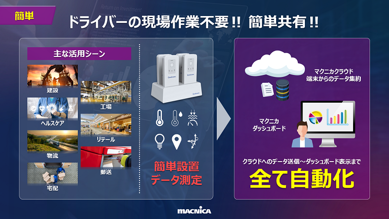
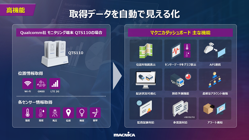
An example of a dashboard: Location information is always visible. By sharing an account, both shippers and carriers can share the information in real time.
lastly
In this article, we focused on one feature of Macnica Tracks™: Delivery Information.
By using this function, you can check the status of each delivery in real time.
Specifically, the system allows customers to grasp information such as delivery progress, arrival forecasts, and even delivery errors at a glance, helping to alleviate customer concerns and quality issues.
In addition, you will be notified immediately via email when delivery status updates or delivery errors occur, allowing you to respond quickly even when you are not checking the dashboard.
This not only improves delivery quality for customers, but also promotes operational efficiency and resource optimization.
If you are interested in this feature, would like to know more about other features, or would like to see the dashboard screen, please contact Macnica.
We also offer free loans, so if you are interested, please feel free to contact us.
Inquiry
In this article, we introduce Macnica Tracks™For any questions, estimates, or other inquiries, please contact us using the form below.