- Smart City/Mobility Business HOME
- Search by use case
-
Search by product/service

- event·
seminar -
Case studies and columns
- Inquiry

Entering an era where the use of satellite data is commonplace
Currently, due to the evolution of satellite development technology and the reduction in costs, small satellites are being launched more frequently. Satellite data, which has only been used for national research purposes until now, is fast approaching a world in which it can be easily used by private companies. At Macnica, we are leveraging our sourcing technology to work with various satellite data providers both in Japan and overseas to solve social and corporate issues using satellite data.
Ground Observation Solution Based on SAR Satellite Data
The use of satellite data for ground observation will further accelerate in the future. Satellite data, which until now has only been used for national scientific research, will soon become available for use by general corporations. Macnica is focusing on data from satellites equipped with a radar called SAR (Synthetic Apeture Radar). In collaboration with Synspective, a leading company in SAR satellite data and its analysis, we are working to solve problems using SAR satellite data. Furthermore, we are also working on developing solutions that combine the SAR satellite data mentioned above with other data such as optical satellite data. It can be used for a wide variety of purposes, including analyzing ground deformation, understanding damage during disasters, and monitoring forest conditions. We look forward to the creation of new ideas through discussions with various companies in the future regarding how this kind of satellite data can be used to solve problems.
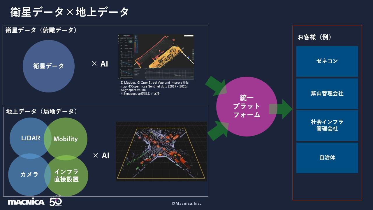
Ground data x satellite data
At Macnica, we also collect and analyze a lot of ground data such as LiDAR and camera data using mobility, etc. By combining this data with satellite data, we can create high-resolution local data + bird's-eye view satellite data. We believe we can build a comprehensive solution. We believe that this approach will enable us to first use satellite data to identify general abnormalities, and then use mobility devices and drones to collect localized data with higher resolution. We believe that by visualizing these on a unified platform, we can achieve seamless management.
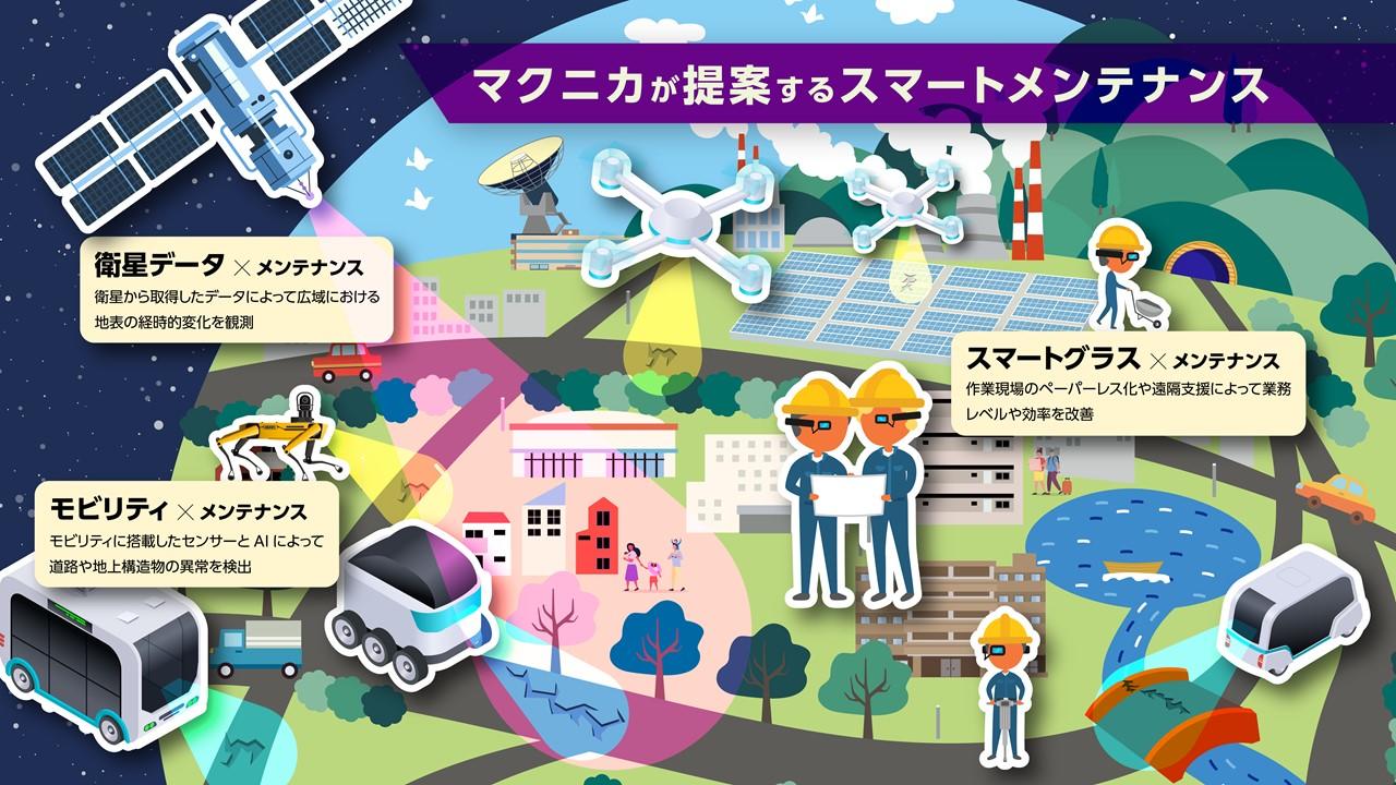
Application example in smart maintenance
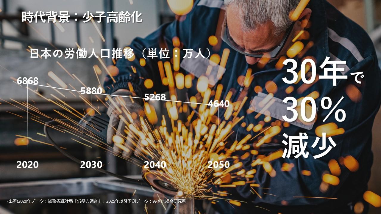
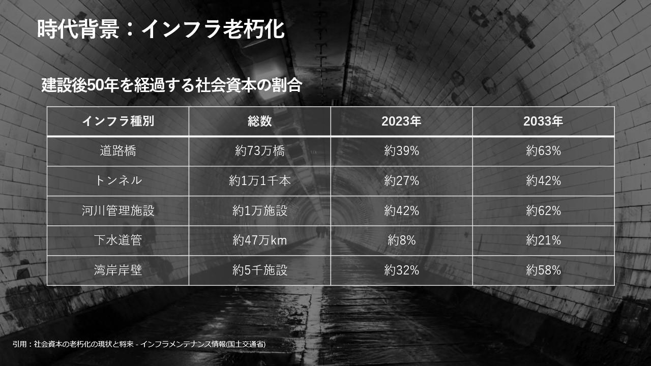
In Japan, it is said that the number of workers will decrease by 30% in 30 years due to the declining birthrate and aging population. In addition, the deterioration of infrastructure such as bridges and tunnels built during the high economic growth period will accelerate further in the future.
We believe that smart maintenance that utilizes advanced technology will become even more important in the future in order to perform infrastructure maintenance with a limited workforce. At Macnica, we are expanding the range of smart maintenance services we can provide by combining satellite data and various solutions.
Inquiry
If you have any questions or concerns about the satellite data utilization support service, please contact us from here. Please feel free to contact us.