- Smart City/Mobility Business HOME
- Search by use case
-
Search by product/service

- event·
seminar -
Case studies and columns
- Inquiry
Overview
Recently, the demand for ranging systems using LiDAR (Light Detection and Ranging) is increasing. This is because LiDAR can measure the distance to a long-range object with high precision regardless of the environment. Furthermore, in the future, in addition to ranging and detection functions, the importance of recognizing what the object is will increase. For example, identifying vehicles and pedestrians in urban areas is an important factor in preventing traffic accidents.
しかし、LiDARを活用した認識システムの開発は容易でなく、対象となる物体を認識するためには、データの収集、AIを活用した認識アルゴリズムの構築、テスト走行、システム修正など、多くの開発工数や時間、費用が発生します。
Macnica provides total support from collecting LiDAR data to building object recognition software. We provide the optimal system for recognizing objects such as cars, pedestrians, and bicycles from point clouds according to customer requirements. Additionally, the output information can be flexibly adjusted depending on the use case, such as detecting intrusion into a specific area or counting the number of pedestrians.
This reduces the man-hours, time, and costs required for customer system development and supports early market introduction.
Features
Industry's highest level of accuracy and speed
It uses Seoul Robotics' algorithm, which boasts top-class performance in terms of speed (FPS) and recognition accuracy in the KITTI benchmark.
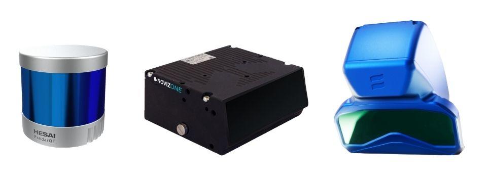
Widely compatible with various LiDAR
Widely compatible with various LiDAR such as Velodyne, Hesai, Ouster, Innoviz, Baraja, Cepton.
Connection of multiple LiDAR
Multiple different LiDAR point cloud data can be displayed on the same UI for object recognition.
good development tools
You can freely customize the output data such as intrusion detection to a specific area, people counting, etc.
Widely compatible with various LiDAR
Business process
consulting
After hearing the environmental conditions and required specifications, we identify the necessary functions and define the requirements.
evaluation
We install the software with a one-year evaluation license on a high-spec notebook PC or industrial PC. You can build an evaluation environment using your existing LiDAR.
* Multiple LiDARs can be connected via a router.
*Although many LiDARs are supported, please contact us to confirm compatibility.
optimisation
If the mobility to be installed or the object to be recognized is special, we will customize it for software optimization.
Implementation
We provide a mass production license for actual operation. We can also provide on-site operational support.
Use Case
Mobility Solutions
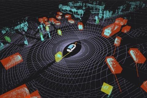
Install LiDAR in mobility to recognize cars, pedestrians, bicycles, motorcycles, etc. Functions such as vehicle speed and course prediction are also implemented.
People flow analysis
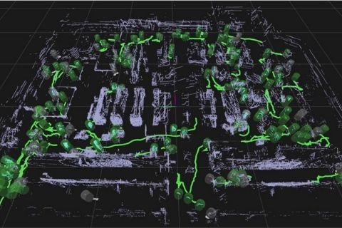
It can be applied to various people flow analysis, such as monitoring social distance in the corona disaster and visualizing the operation efficiency of employees. Also, unlike a camera, it does not show your face or nameplate, so you can rest assured from the viewpoint of privacy.
transportation system
It is possible to analyze the shape and speed of passing vehicles installed in ITS.
In addition, by combining it with a traffic signal system, it is possible to construct a simple traffic system, such as controlling the signal (turning it red) when a car enters a specific area. .
In addition, it can be used in various use cases such as construction machinery and security.
demo video
Inquiry
If you have any questions or concerns about the LiDAR recognition algorithm development support service, please contact us from here. We can provide detailed materials and demonstrations, so please feel free to contact us.