
Overview
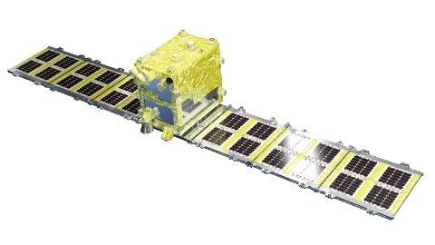
Synspective’s small SAR satellite technology derives from the Japanese government’s innovative R&D program, ImPACT. Our small SAR satellite “StriX” can target data with a ground resolution of 1-3m, single polarized (VV), and a swath width of more than 10-30km.
The StriX observation modes are Stripmap and Sliding Spotlight mode and each satellite has an SAR
antenna that is 5 meters in length and stowed during launch. The simple design of the satellites allows for affordable development of the constellation.
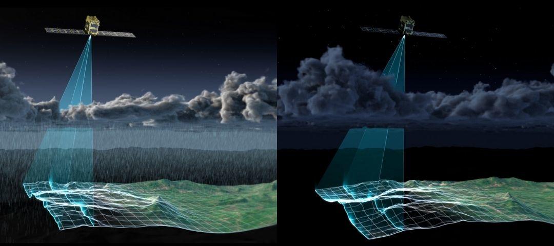
The SAR (Synthetic Aperture Radar) sends microwaves from the satellite to Earth and receives the reflected signal to create an image of the target area. The observation by the SAR enables twenty-four hour monitoring, even with cloud coverage, when optical earth observation satellites are less effective. The StriX satellites use X-band for precise monitoring. These features are suitable for the monitoring of the cities and infrastructures that are Synspective’s primary targets.
Roadmap
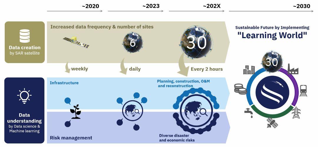
Synspective aims to build a constellation of 6 satellites by 2023 and 30 satellites by the late 2020s. A constellation of 30 satellites in low Earth orbit will enable the observation of natural disasters occurring anywhere in the world within a 2-hour timeframe.
Data Understanding
Synspective is capable of observing the entire Earth's surface and converting it into data. We provides the Next-Gen Satellite Solutions that solve customers’ problems by utilizing satellite data. In addition, the combination of various data sets (IoT data, PoS data, GPS, thermal sensors, etc.) with information from SAR images can speed up important decision-making processes.
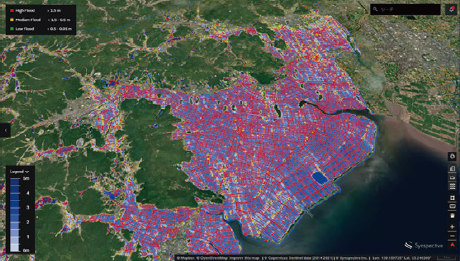
Land Displacement Monitoring (LDM)
Our unique inSAR* analysis detects fluctuations over a large surface area, in chronological order, with SAR satellite data which has a millimetre-level accuracy. You can reduce the time and costs of traditional observation or management techniques.
*inSAR - Interferometric SAR. The technology to detect land displacement with millimetre accuracy.
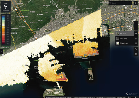
Flood Damage Assessment (FDA)
Unlike the conventional observation method, the SAR satellite enables all-weather ground observation, and it is possible to quickly evaluate inundation damage in the broader area when a flood occurs. FDA evaluates inundation damage (inundation area, inundation depth, damaged roads, damaged buildings) as a measure during disaster response.
Disaster Damage Assessment (DDA)
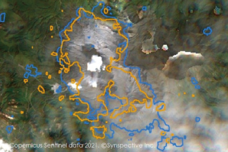
By utilizing SAR satellite data, which is not affected by time or weather, DDA determines the changes that may have happened over the same area before and after a land disaster occurs and support appropriate following decisions.
Movie
Click here to download the brochure.
Click here to contact us.